The Scomodo Interactive Maps project is a digital mapping initiative developed for the cultural association Scomodo, focused on visualizing and analyzing aggregation spaces, social struggle locations, and study environments across Bari, Italy. Created as part of a collective research article examining urban spaces and youth accessibility, this project combines data processing, geospatial analysis, and interactive web visualization to document the social infrastructure available to young people in the city.
The Scomodo association has long been concerned with the availability and accessibility of physical spaces for youth, making this mapping project a natural extension of their mission. The interactive platform serves multiple purposes: documenting existing aggregation spaces, collecting community-reported locations through questionnaires, integrating OpenStreetMap data for comprehensive urban amenity mapping, and providing an accessible tool for citizens to explore available spaces in their city.
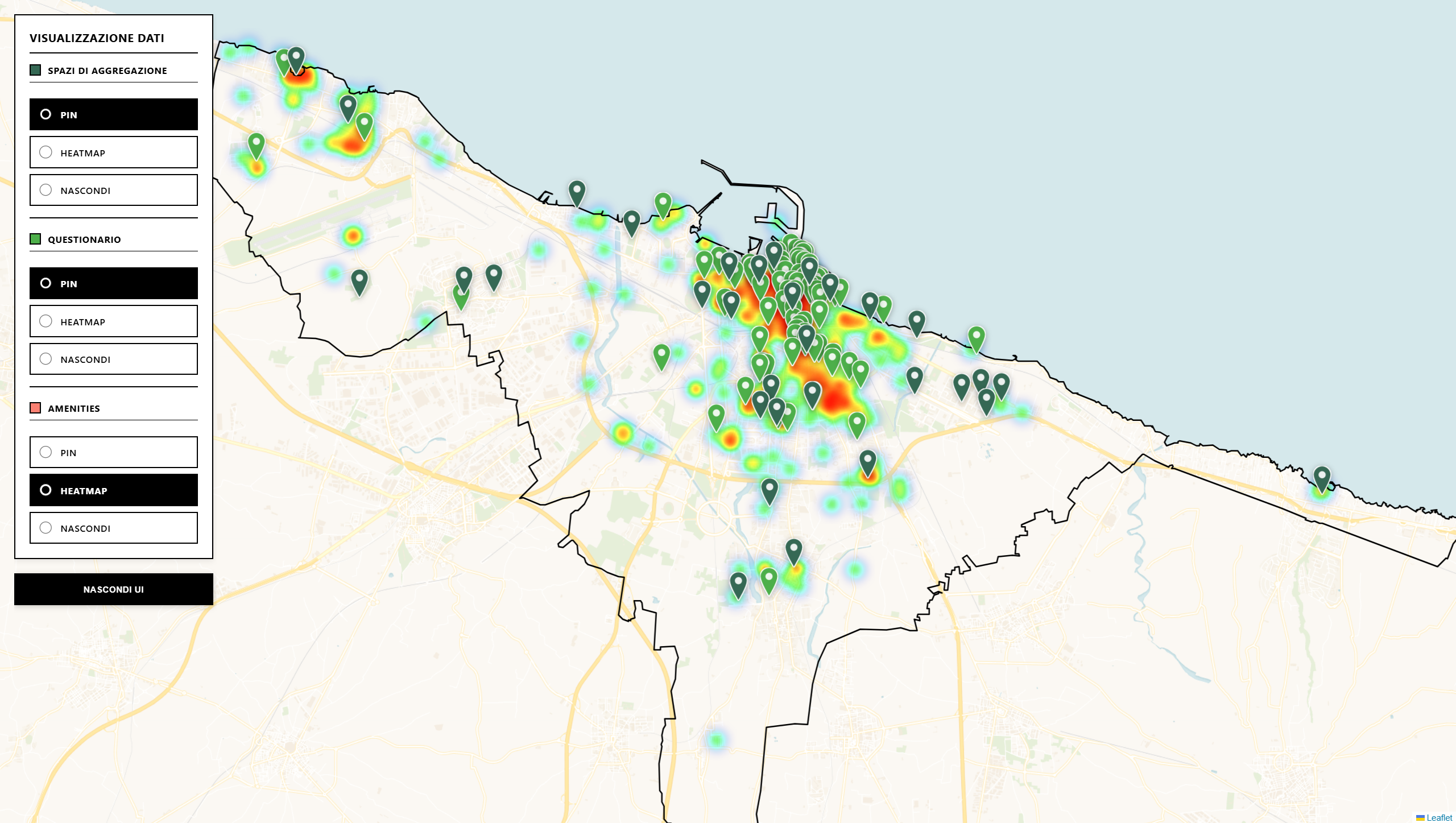
The project consists of three distinct interactive map applications, each designed with specific use cases in mind, alongside a robust data processing pipeline that transforms raw geographic data into usable JSON datasets. The mock version of the pages you find the link to in the sidebar is hosted on Cloudflare Pages.
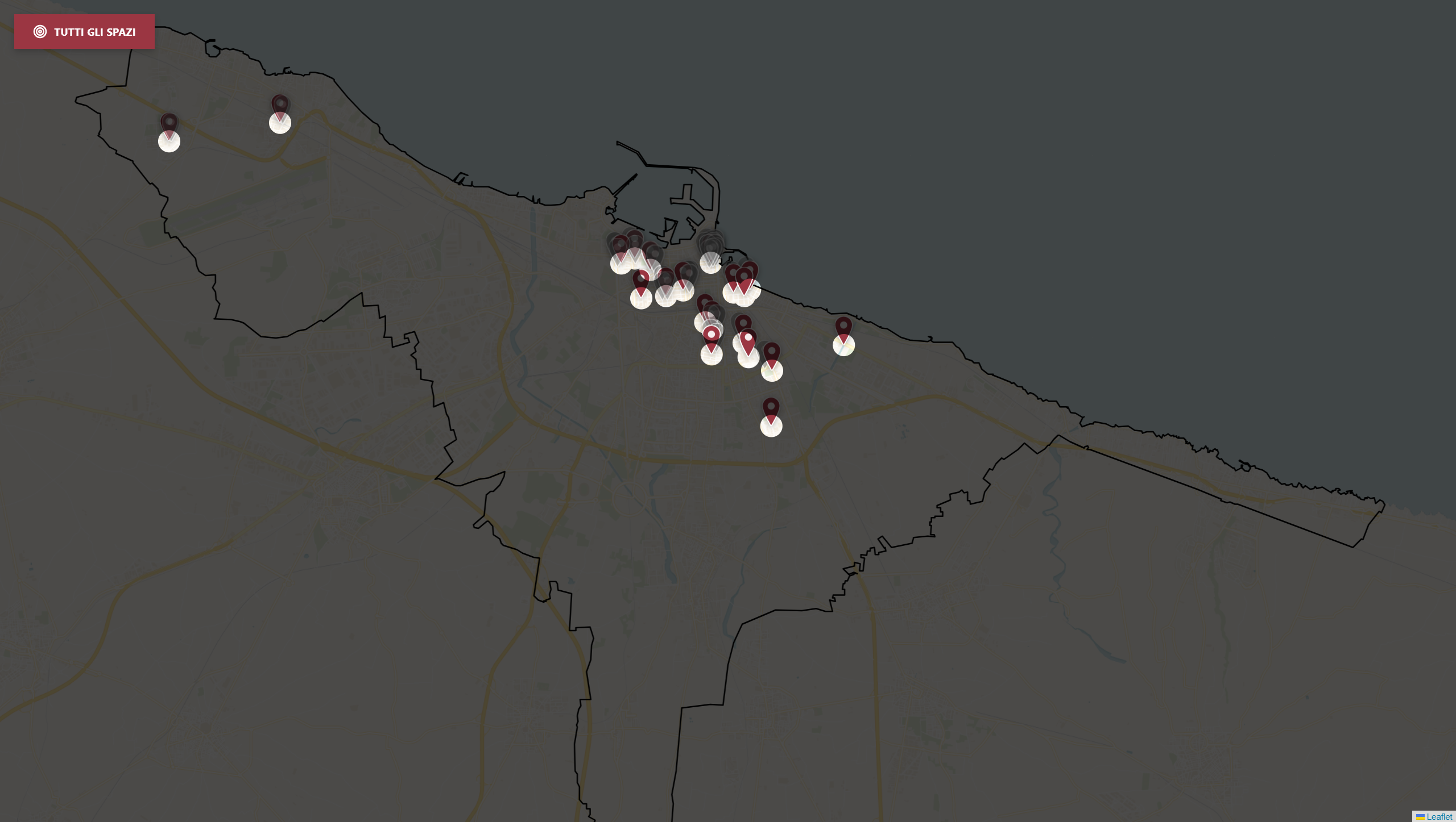
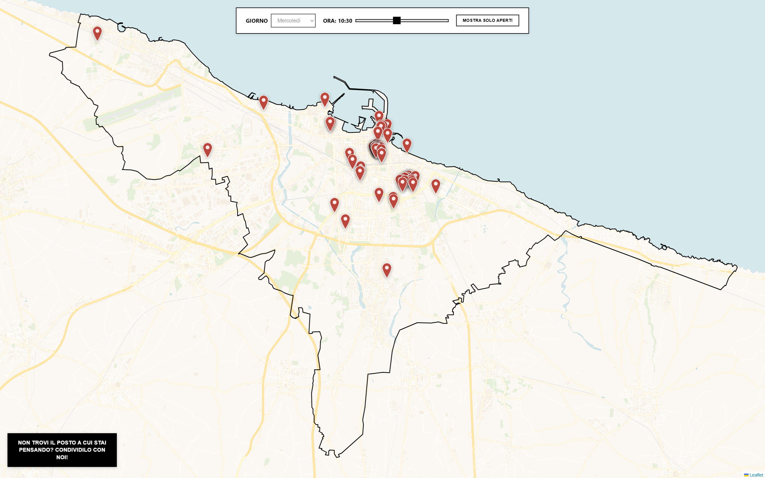
Throughout this project, I was responsible for the complete development lifecycle from data transformation to deployment. I designed and implemented the data processing pipeline using Python and Jupyter notebooks, creating automated scripts to transform raw Excel data into structured JSON datasets and integrate OpenStreetMap data through the Overpass API. I developed three distinct interactive web mapping applications using JavaScript, Leaflet.js , and modern ES6 modules, each with unique interaction patterns for specific use cases: multi-layer visualization with heat maps, spotlight-based focused exploration, and time-based filtering for opening hours of study facilities.
I implemented geospatial analysis features including coordinate validation, distance calculations for proximity filtering, and polygon boundary overlays for neighborhood visualization. The front-end development involved creating responsive user interfaces with custom SVG overlays for the spotlight effect, interactive time selection controls, and detailed information panels with structured data display. I also integrated form handling with the Web3Forms API for community submissions, implementing client-side validation and error handling to ensure data quality.
The deployment process involved configuring the project for hosting on Cloudflare Pages , optimizing asset delivery. Throughout the project, I collaborated with the Scomodo association to understand their research needs and translate them into functional technical requirements, resulting in a suite of tools that support their mission of documenting and analyzing urban spaces for youth accessibility in Bari.